Useful Datasets
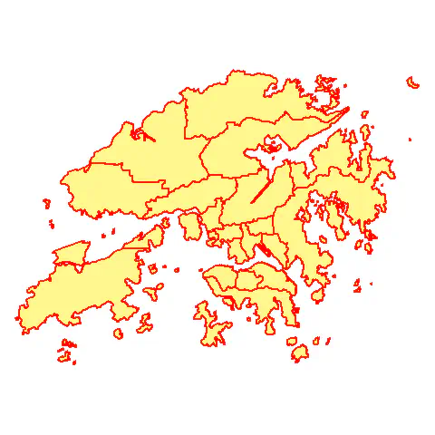
 Shape of Hong Kong generated from GADM
The following datasets and documentation are open to all. I hope they benefit your research! 📚
Climate
- National Centers for Environmental Predictions (NCEP) Reanalysis II: air temperature, precipitation water, and other meteorological variables at various pressure levels (daily & monthly over 1979–present; 2.5º-by-2.5º) [Kanamitsu et al, 2012]
Ammonia (NH3)
IASI satellite-measured column concentration (0.01º-by-0.01º) [Van Damme et al. 2018]
Ammonia Monitoring Network (AMoN) in situ ground measurement of the 2-m concentration (site data) [National Atmospheric Deposition Program 2014]
MASAGE_NH3 – a global agricultural emission inventory (monthly; 2º-by-2.5) [Paulot et al. 2014]
A Chinese agricultural emission inventory by Peking University (monthly; 0.5°×0.667°) [Zhang et al. 2018]
Nitrogen Dioxide (NO2)
- Gridded concentration derived from OMI satellite measurement by the University of Wisconsin-Madison (monthly over 2006–2018; 12 km-by-12 km) [Harkey et al. 2015]
Fine Particulate Matter (PM2.5)
- A global concentration estimate based on the Bayesian hierarchical model (annually over 2010–2016; 0.1° × 0.1°) [Shaddick et al. 2018]
Agriculture
Crop calendar dataset by the University of Wisconsin-Madison (5’-by-5’ & 0.5º-by-0.5º ) [Sacks et al. 2010]
Harvest area and yield for 175 Crops by EarthStat (for the year 2000; 5’-by-5’) [Monfreda et al. 2008]
Crop allocation to food, feed, and nonfood by EarthStat (5’-by-5’) [Cassidy et al. 2013]
Nutrient Application for Major Crops (for the year 2000; 5’-by-5’) [Mueller et al. 2012]
Soil
- Harmonized World Soil Database v1.2 [Fischer et al. 2008]
- Land mask, terrain elevation, slope (30"-by-30" & 5’-by-5')
- Land use and land cover: rain-fed cultivated land, irrigated land, forest land, grass/scrub/woodland, built-up land (residential/infrastructure), barren/very sparsely vegetated land, or water bodies (5’-by-5')
- Soil qualities for crop production: nutrient availability, nutrient retention capacity, rooting conditions, oxygen availability for roots, excess salts, toxicity, and workability (5’-by-5')
Geography
- GADM database of Global Administrative Areas (shapefiles; check out my GitHub repo on how to use it in R)